
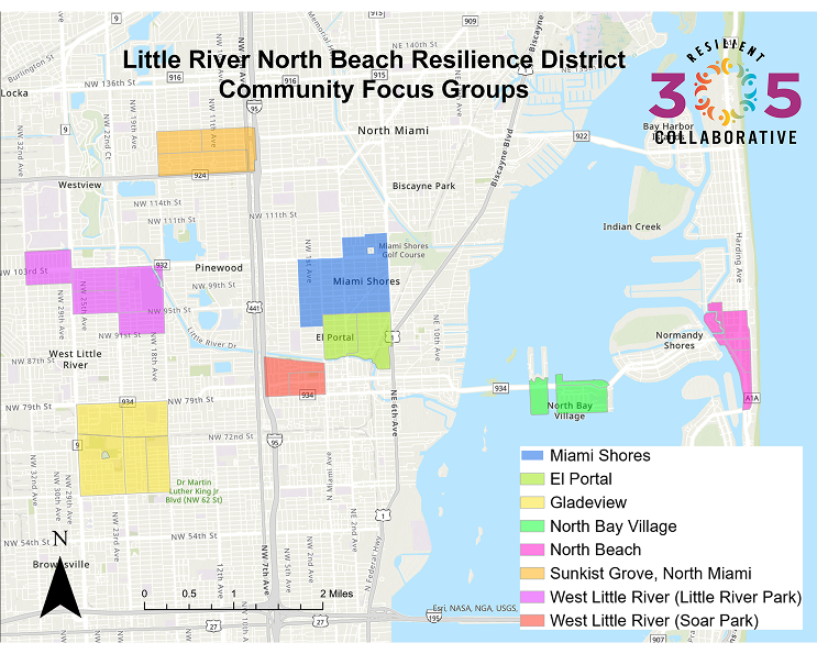
R305C launched the Little River to North Beach Resilience District Project in 2020. This area of eight communities was chosen because its diverse socioeconomic conditions and exposure to natural hazards make it representative of our entire community.
Tested and refined Resilience Learning System year-by-year
R305C science is being used by Miami-Dade County’s Office of Environmental Risk and Resilience
Science produced by our AdSci project contributed to the Countywide Resilience Hub Network Strategy and Guidebook
Helped build community awareness of extreme heat as a hazard
Contributed to lower, experimental thresholds for heat advisories and excessive heat warnings issued by the NWS Weather Forecast Office in Miami
The City of Coral Gables is using water level data supported by AdSci funding as part of their Coral Gables Smart City Hub
Our flood monitoring stations are hosted on the SECOORA data portal to ensure these data resources continue to be available beyond the life of the project
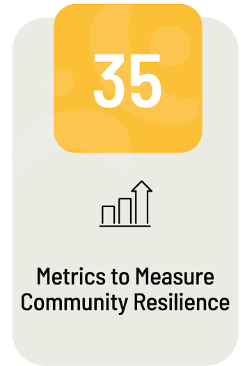
We use comprehensive, data-driven metrics co-designed with community members and government staff to track resilience outcomes over time.
.png)

.png)
.png)
.png)
.png)
.png)
.png)
Gives County planners and public officials access to the MEERIA rubric, a structured decision-making framework that aids infrastructure planning by going beyond traditional benefit-cost analysis.
Learn MoreIs a community-based air quality monitoring program in Miami-Dade County, jointly developed by Miami-Dade County, the Resilient305 Collaborative, and Catalyst Miami.
Learn Moreis a collaborative effort between community, business, government, and university stakeholders to identify and prioritize nature-based solutions thatmaximize flood and habitat protections.
Learn More

.png)

.png)
.png)
.png)